Specialised Imagery Services Catering to Your Needs
At Mathieson Imagery, we offer a comprehensive range of drone services designed to meet your unique needs. From high-definition aerial imaging and detailed mapping to dynamic livestreaming and precise inspections, our cutting-edge technology and expert team deliver exceptional results. Explore our services to see how we can enhance your project with unparalleled aerial insights and precision.
What We Do
Aerial Imagery Services
Asset inspections, cover complex infrastructure like roads, bridges, and power poles. Drones are essential for government bodies, insurers, engineers, and construction firms, providing quick and safe imaging, videos, and 3D models. This approach is faster, safer, and more cost-effective than traditional manual inspections. As a drone asset inspector, you'll evaluate both urban and remote infrastructure using specific equipment.


Photography and Videography
Photography and Videography, leverage drone technology for capturing detailed images and videos. This is popular not just for surveying and mapping but also in real estate and entertainment. Drone photographers and videographers use RPAS and high-end cameras to create footage for movies, TV shows, ads, and real estate marketing, specialising in the creative aspects of drone operation.
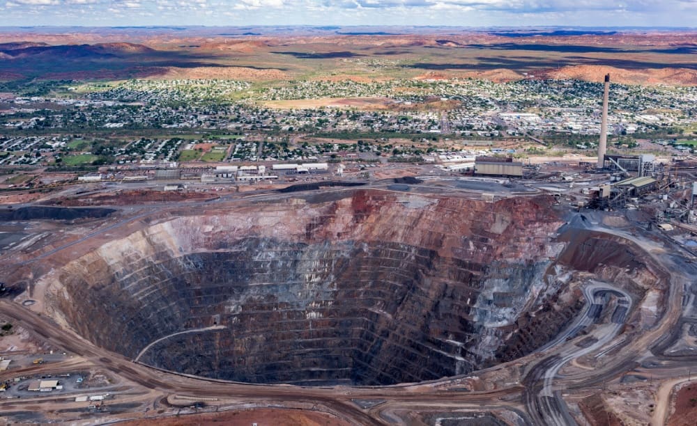
Aerial Mapping
Aerial Mapping Services, use drones to capture extensive land data, bypassing distance and terrain limits. Ideal for surveying, mapping, documenting property development, and creating project maps, drones support industries such as construction, mining, city planning, inspections, infrastructure, agriculture, and nature preservation. Drone surveyors use advanced platforms to collect imagery, LiDAR, GPS, and thermal data, which is processed into accurate survey point cloud data and 3D modelling and reports.


Emergency and Disaster Management
Emergency Services, utilise drones to assist communities in disaster recovery. Mathieson Imagery employs advanced drone technology for rapid damage assessment and detailed mapping, essential for efficient response and recovery efforts. Our drones can assist and provide a crucial role in assisting emergency services and streamline the recovery process and support affected areas effectively.
Experience the Difference
Discover the difference with Mathieson Imagery’s expert services. Contact us to explore how our advanced technology and skilled team can enhance your project with precision and efficiency. Reach out today to discuss your needs and get a tailored quote.
Documenting Evidence with Precision
Forensic photography captures high-resolution stills and video footage, documenting crime scenes, industrial accidents, and insurance evaluations. Using advanced drone and terrestrial equipment, we ensure accurate, detailed evidence for legal and investigative purposes.


Revolutionizing SAR Operations
The Search and Rescue (SAR) Program supports teams worldwide, using drones and advanced technologies to locate and recover people in danger. This guide helps organizations implement SAR drone programs effectively.